Seeing Is Believing At NETWC

Richard TT FormanThe Northeastern Transportation and Wildlife Conference is taking place in Burlington, Vermont this week (Sept. 21 – 24). The technology of the hour is the game camera. It’s cheap, it’s non-invasive, and it’s cheap. One presenter confessed that there were probably better tools for his project — radio collaring, for example — but that it was better to have some data for his project now than waiting around for funding for better technology.

The next step is to become more adept at using game cameras. In that same presentation, there was a problem with smaller animals not being picked up by the cameras. At least one of the conversations after the session was about how to better place and aim the cameras to pick up all the species included in the study (which can be difficult if it includes both weasels and moose).

Another aspect touched on by a poster from the New Jersey Division of Fish and Wildlife, is processing all those photos. This poster suggested using software that lets analysts pick descriptions from a pull-down menus to standardize the interpretations for better data crunching.

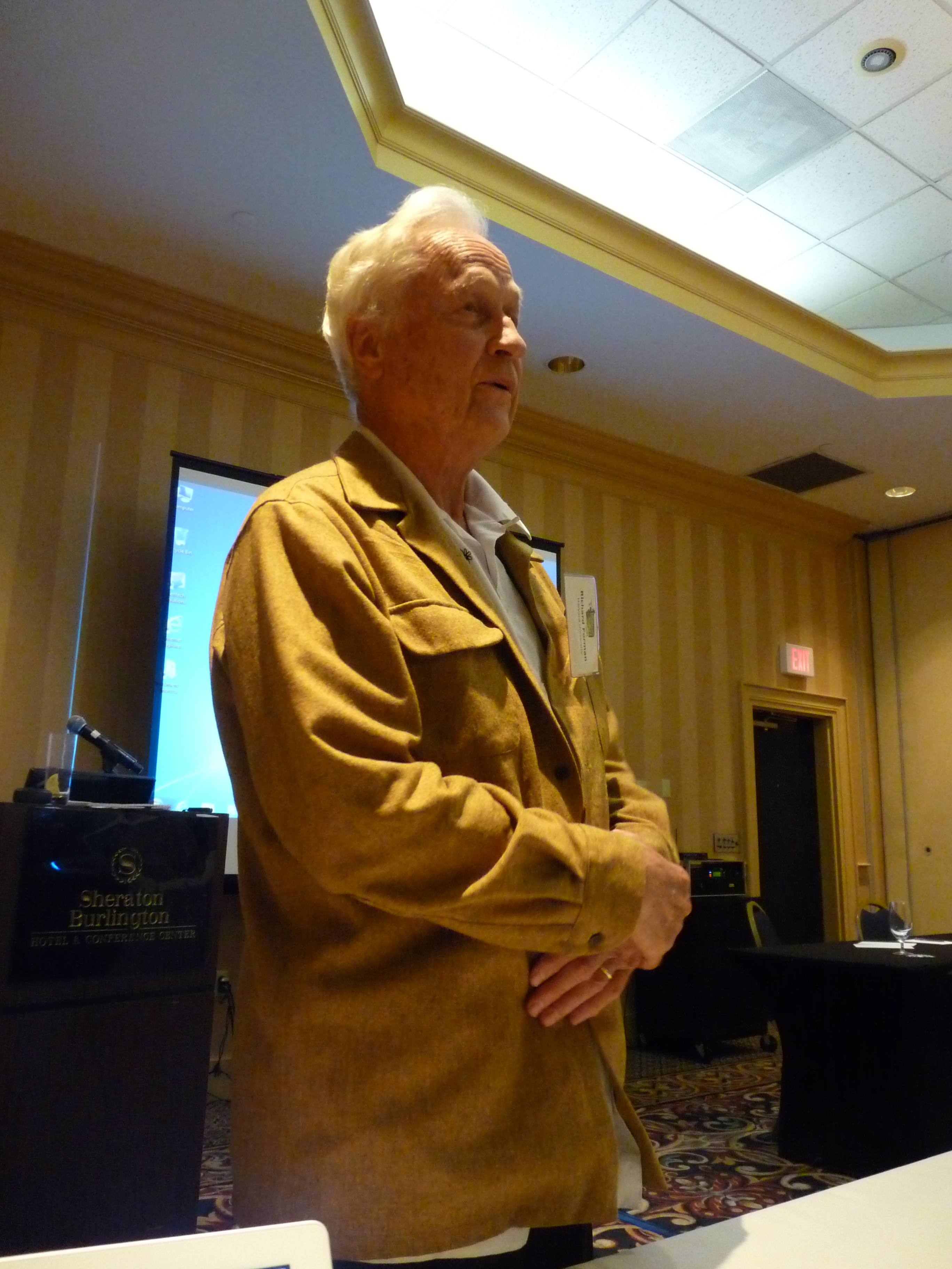
Photo: You never know who you will meet at a conference. Harvard researcher Richard T.T. Forman, known as the “father of road ecology,” was one of the NETWC attendees. Here, he adds his thoughts on a documentary that he appeared in as an expert.

Geolocators in The Auk

Auk 4 13 coverGeolocators are a relatively new tool that allows researchers to track the movements of small animals, such as birds.

Instead of sending and receiving a radio signal, geolocators record the angle of sunlight at given hours of the day. You must collect the geolocator unit to retrieve the data. Without the send and receive functions, the unit can be much smaller than other tracking devices. Geolocators have been used even on small songbirds. An algorithm lets you translate the sun angle at a given time into a latitude.

Clearly, it’s a technology with a lot of potential and a lot of limitations. If you are interested in how geolocators can inform your own research, check out the April issue of The Auk, which contains two special sections on geolocator research. The issue’s introductory article is a primer on geolocators, and it’s open access. Read it here.

New Tech: Ground Penetrating Radar

Texas researchers used ground penetrating radar to study pocket gophers. The researchers were able to map the pocket gopher’s tunnels to a depth of over a foot. They were also able to spot animals within the tunnels and differentiate between and underground pipeline and the pocket gopher tunnels. They wrote about it in a paper in the peer-reviewed journal Wildlife Society Bulletin.

While pocket gophers are a nuisance in places like Washington State, the subspecies studied is a species of concern for the US Fish and Wildlife Service. The research took place on a naval base.

The researchers feel that ground penetrating radar can be helpful in other wildlife management applications.

Read the Wildlife Society Bulletin paper, here. (Fee or subscription required for full text.)

Trail Cam as PR Assistant

Do you have an under-used wildlife refuge that you would like to promote? A bit of wildlife habitat that needs protecting, but has been forgotten? Strap some trail cameras along likely wildlife corridors and let the resulting photos help you get the word out.

People believe what they see, and photos can show the wildlife diversity in a particular area. And people generally love pics of either cute or scary creatures, so media looking for a “brite” love animal pics.

This story in the San Francisco Chronicle has some trail cam shots, and some wonderful wildlife shots from what must be professional photographers. And yes, the Point Reyes National Seashore is hardly a forgotten wildlife refuge (it has 2.5 million visitors annually), but the pictures make a point. The story, meant to celebrate the seashore’s 50th anniversary, got a lot of play from the Chron and on the Internet. Read the story here.

Photo: A black-tailed deer inspects a trail camera at Point Reyes National Seashore. Photo courtesy of Point Reyes National Seashore.

Birds, Wind Turbines, and Radar

In the Tehachapi Mountains north of Los Angeles, migrating birds flow through a canyon “like a living river of birds,” the Los Angeles Times says. These locations are not only attractive to birds, but to wind power developers as well.

These developers are thinking about using radar units and experimental telemetry systems to avoid killing birds, the article says.

The radar systems cost about $500,000, the article reports, and work best in flat, treeless places. (The radar company mentioned in the article, DeTect, Inc. appears to work mostly with airports, which are definitely flat, treeless places.) Several radar units would be needed in a place like the Tehachapi mountain canyon.

The article also mentions linking the telemetry units on individual condors to cut-offs at wind power facilities. If a tagged condor flies too near a wind farm, the rotors stop spinning.

Read the article in the Los Angeles Times, here.
Info on the bird and bat radar systems from DeTect, mentioned in the article, here.

Caribou Cam

It’s not easy studying the behavior of woodland caribou. If it’s not deep snow and freezing temperatures, then it’s bugs. Lots of bugs. However, a team of Canadian researchers attached high resolution cameras to five caribou (Rangifer tarandus caribou) and recorded video and took GPS readings for 20 weeks.

Not the woodland caribou in the study. Other woodland caribou.

According to their paper in the Wildlife Society Bulletin, the resolution on the video was good enough for the scientists to identify the plant species that the caribou ate. Six percent of the footage was unusable because of fogging or snow, but for the most part the project removed some of the mystery of woodland caribou behavior.

“Critter Cams” have been used by the National Geographic Society, in part, if not mostly, to create entertaining videos for the general public, but in this case, the caribou cam has contributed information on an otherwise difficult to study animal.

Read the Wildlife Society Bulletin paper here. (Requires subscription or fee.)

Photo: Woodland caribou, photo by Erwin and Peggy Bauer, courtesy of the US Fish and Wildlife Service

App Happy

You may be using a smartphone to enter data in the field (hey, it beats lugging a laptop), and now the public can get in on wildlife conservation apps, too.

The National Wildlife Refuge System has been busy adding interactive smartphone applications. Patuxent Research Refuge, outside Washington, D.C. and Las Vegas National Wildlife Refuge in New Mexico are putting QR codes at trailheads. The Aransas Wildlife Refuge in Texas, and Great Meadows in Massachusetts, are putting QR codes on visitor brochures, kiosks, interpretive panels and printed trail maps.

That’s in addition to the app the system introduced last year, MyRefuge, featuring maps of scores of refuge recreation trails and other visitor attractions. Also last year, the system introduced the interactive iNature Trail at J.N. “Ding” Darling National Wildlife Refuge in Florida.

There’s more, and you can read about it in the National Wildlife Refuge System press release, here.
Access MyRefuge, here.

The BirdLog apps lets bird watchers (and researchers) enter data into eBird in the field using an iPhone or Android smartphone. An app for iPad is coming soon. A portion of the cost goes to Cornell Lab of O conservation activities.

Read the Cornell Lab of Ornithology release here.
The eBird press release is here.

Getting injured animals to wildlife rehabilitators and keeping the public safe as they try to assist injured wildlife can be difficult. It’s hard to be available 24-hours a day. In the Boulder, Colorado region a new web site and app, AnimalHelpNow, lets people report injured wildlife on their smartphones. The developers hope to have versions for other parts of the country soon.

Read (or listen) to the National Public Radio story on the app, here. Lots of links to follow to get the app and other information.

Finally, it’s not all sunshine and happiness is app-land. New apps that give Yellowstone visitors the locations of bears and other watchable wildlife have park advocates worried. The park’s bear jams are already dangerous, both as a travel hazard and because people get too close to the animals.

Read the article in USA Today.
Read the blog post in Field & Stream

Photo: A visitor prepares her smartphone to scan quick response (QR) codes along the iNature Trail at J.N. “Ding” Darling National Wildlife Refuge, FL

Tool: Infrared Monitoring

Thermal image of wolf with a spot mimicing mangeIn a recent study on the origins of the fungus that causes white nose syndrome in bats, the bats in the study were monitored with infrared cameras. This allowed the researchers to see when the bats were rousing (they need to warm up first).

Read a mention of the infrared monitoring in this Associated Press story on the Yahoo News site.
You can also find the Proceedings of the National Academy of Sciences paper here, but you need a subscription or to pay a fee to read the whole paper.

A more common use for infrared imaging has been for wildlife surveys. For example, Tennessee Wildlife Resources Agency has used thermal imaging to survey the ratio of bucks to does and does to fawns for deer management. But this technology can do more.

Scientists are using infrared thermal imaging cameras to detect sarcoptic mange in Yellowstone wolves. The patches of bare skin caused this form of scabies stress the animal because the calories used up to compensate for the heat loss can doom the animal.

Read an article on an early stage of the study in the Billings Gazette.
Read information from the US Geological Survey, here.
And a tip of the hat to Wired Magazine, which dedicated a full page to the story in its May 2012 issue. (Sorry, no direct link because the May issue wasn’t online when this was posted.)

While the Billings Gazette article describes the scientists renting a $40,000 camera, in the Wired Magazine update, $4,000-$5,000 per camera is the price mentioned. There seem to be a lot of possibilities for using infrared thermal imaging in wildlife management that go beyond surveys.

Photo: Thermal image of a wolf with a small bald spot on its rear leg, from the initial test of concept. Courtesy of the US Geological Survey.